 Total View: 91
Submitting the form below will ensure a prompt response from us.
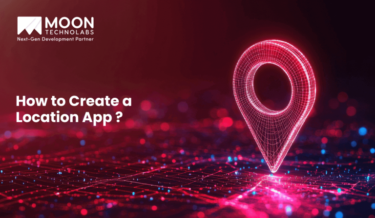
Location-based apps have quietly become part of everyday digital behavior. From ride-hailing and food delivery to fitness tracking, dating, logistics, and retail discovery, users now expect apps to understand where they are and respond in real time.
If you’re planning to build one, the real challenge isn’t just “using maps” — it’s designing a system that is accurate, scalable, privacy-aware, and actually useful to users.
This guide explains how to create a location-based app, covering architecture, technology choices, development steps, cost considerations, and practical code examples where needed.
A location-based app is a mobile or web application that uses a user’s geographic location to deliver personalized content, services, or functionality. The location data can be used in real time (live tracking) or contextually (location history, nearby places, zones).
Common examples include:
At the core, these apps rely on GPS, Wi-Fi, cellular data, and mapping services to determine a user’s position and act on it.
A location-based app works through a combination of device sensors, APIs, backend logic, and mapping services.
High-level flow:
This happens continuously or on demand, depending on the use case.
Not all location apps need real-time tracking. Decide early:
This decision impacts cost, battery usage, and architecture.
Users should understand why location is needed.
Bad UX here leads to permission denial and app drop-offs.
Android (Kotlin – Fused Location Provider):
val locationRequest = LocationRequest.create().apply {
interval = 10000
fastestInterval = 5000
priority = LocationRequest.PRIORITY_HIGH_ACCURACY
}
This ensures balanced accuracy and battery usage.
Example: Distance calculation using Haversine formula (Node.js):
function getDistance(lat1, lon1, lat2, lon2) {
const R = 6371;
const dLat = (lat2-lat1) * Math.PI/180;
const dLon = (lon2-lon1) * Math.PI/180;
const a =
Math.sin(dLat/2) * Math.sin(dLat/2) +
Math.cos(lat1 * Math.PI/180) *
Math.cos(lat2 * Math.PI/180) *
Math.sin(dLon/2) * Math.sin(dLon/2);
return R * 2 * Math.atan2(Math.sqrt(a), Math.sqrt(1-a));
}
This logic is commonly used for “nearby” results.
Geofencing triggers actions when a user enters or exits a defined area:
Geofences are powerful but must be used sparingly to avoid battery drain.
Best practices:
This is critical for long-term retention and compliance.
Costs vary based on complexity:
Factors affecting cost:
Building a reliable location-based app requires more than map integration. It demands geospatial expertise, scalable backend design, and strong UX decisions.
Moon Technolabs helps businesses design and develop location-aware applications with:
Whether you’re building a hyperlocal marketplace, logistics app, or on-demand platform, the approach is always tailored to the use case.
From GPS integration to real-time tracking and secure APIs, Moon Technolabs helps you design and build high-performance location-based apps.
Creating a location-based app is not about “adding maps” — it’s about context, accuracy, and trust. The best apps use location data intelligently, respect user privacy, and deliver real value without draining batteries or overwhelming users.
By choosing the right tech stack, designing permission-friendly UX, and building scalable backend logic, you can create a location-based app that users rely on daily — not one they uninstall after a week.

Jayanti Katariya is the CEO of Moon Technolabs, a fast-growing IT solutions provider, with 18+ years of experience in the industry. Passionate about developing creative apps from a young age, he pursued an engineering degree to further this interest. Under his leadership, Moon Technolabs has helped numerous brands establish their online presence and he has also launched an invoicing software that assists businesses to streamline their financial operations.
Submitting the form below will ensure a prompt response from us.
We refine our expertise to deliver innovative business solutions.


500 N Michigan Avenue, #600, Chicago IL 60611
13500 Long Is Dr, Pflugerville, TX 78660, USA
C-105, Ganesh Meridian, S.G. Highway, Ahmedabad, GJ 380060
“ I highly recommend Moon Technolabs as the quality of service is wonderful. We have hired this company to develop the product based on some complex & technical issues. We get the best quality services as compared with others in the market. Huge Thanks to Moon Technolabs as the team is always ready to give the solution all time.”
“ Moon Technolabs is a pioneer in the WebRTC based project as they have fixed complicated segments of the module by fulfilling different product lines by providing 24X7 customer support. We really recommended Moon Technolabs as they are able to develop products as per the module deadline and project timeline.”
“I am happy to recommend Moon Technolabs for their app development services. They successfully developed apps for me, and I am highly satisfied with the overall outcomes. The development team has swiftly addressed the issues with responsive and effective communication to understand the requirement quickly and actively resolve the back-and-forth problems that arose...”
“Moon Technolabs is the best company that provides advanced apps and websites development services in the USA and Europe. I am a newbie to develop my app with an external team. I am really happy to work with them as I am not that much mobile apps user. Here, the team and specially the CEO of Moon Technolabs helps me to let me know about the benefits of my app to generate revenue....”